This is the second half of the fourteen-day trip. That one finished in Xining, where I put the family I'd been driving for two weeks on a plane, and the sensible thing to do next is what any map app will tell you: point the car south-east and cover the kilometres. There is a fast way home from Xining and it takes about a day and a half.
I did not take it. I went west first, to the lake and the salt flats — the wrong direction, three hundred kilometres of it — and then came home the long way, down through Golog prefecture, over into Sichuan at Aba, and down the valley through Barkam, Miyaluo and Wenchuan. Three days, two nights, one driver, no clients. Nobody in the back seat means the schedule is mine: I stopped when the light was good, charged when the car needed it, and slept where the road put me.
Names of guesthouses, restaurants and towns are given in English with the Chinese in brackets — tap the bracket to copy it, so you can show it to a driver or a waiter.
The basics
- Route
- Xining → Qinghai Lake → Chaka Salt Lake → Gonghe → Heka → the Tang–Tubo hot springs → Anemaqen → Maqin → Jigzhi → Aba → Barkam → Zhegu Mountain → Miyaluo → Bipenggou → Wenchuan → Chengdu
- Days
- 3 days, 2 nights
- When I drove it
- August 2026 — straight after the fourteen-day trip
- Best season
- Late June to early October. Wild mushroom season in Barkam is August; the red leaves in the Miyaluo valley are October; the ski area at Zhegu Mountain runs from November to March
- Best light
- Dawn on Qinghai Lake; the last hour on the Golog grassland; late afternoon on the Barkam river front
- Pace
- Three long driving days with almost nothing between them. This is a road trip, not a stay-put trip
- Where you sleep
- Camped at the hot spring · a hotel in Barkam
- Driving
- Your own car, or a chartered car and driver
The route, leg by leg
- XiningStart · Day 1~2,261 m 150 km · 2–2.5 h
- Qinghai LakeDay 1~3,196 m 150 km · 2–2.5 h
- Chaka Salt LakeDay 1~3,059 m 170 km · 2–2.5 h
- Gonghe (charging)Day 1~2,830 m 80 km · 1.5 h
- Heka (charging, dinner)Day 1 125 km · 2.5 h
- Tang–Tubo hot springs (camp)Night 1~3,900 m 280 km · 5 h
- AnemaqenDay 2~6,282 m 80 km · 1.5 h
- Maqin (lunch)Day 2~3,700 m 205 km · 2.5–3 h
- JigzhiDay 2 75 km · 1.5 h
- Aba (into Sichuan)Day 2~3,290 m 240 km · 4 h
- BarkamNight 2~2,600 m 65 km · 1 h
- Zhegu MountainDay 3~3,733 m 35 km · 0.5–1 h
- Miyaluo & GulergouDay 3~2,700 m 75 km · 1.5 h
- BipenggouDay 3 80 km · 1.5 h
- WenchuanDay 3 95 km · 1.5–2 h
- ChengduFinish · Day 3
Approximate driving distance and time from one stop to the next (read top to bottom), not counting time spent at them.
Quick answer: the fastest way from Xining to Chengdu leaves the lake to the west of you and the mountains to the east of you, and gets the job done. This route is the opposite of that: it adds a loop out to Qinghai Lake and Chaka, then follows the new expressway corridor through Golog — the one that only linked Sichuan and Qinghai at the end of 2022. If what you want is to get home, take the fast road. If you have three days and want the drive itself to be the trip, this is one of the best stretches of road I know, and it is almost always empty.
At a glance
| Day | Where you sleep | The point of the day |
|---|---|---|
| 1 | Camped at the hot spring (~3,900 m) | Qinghai Lake and the Chaka salt flats, then two charging stops, dinner in Heka and a soak at altitude |
| 2 | Barkam (~2,600 m) | Anemaqen, lunch with friends in Maqin, and the empty new expressway over the pass into Sichuan |
| 3 | Home | The Barkam morning market, then down the valley: Zhegu Mountain, Miyaluo, Bipenggou and Wenchuan |
Day 1 — West to the lake, then south to a hot spring
Out of Xining the road climbs onto the plateau and the first real stop is Qinghai Lake , about 150 km from the city. It deserves better than a paragraph, so here is the honest version of what you are looking at.
It is the largest lake in China — a little over 4,500 square kilometres of it, at about 3,196 m, with roughly 360 km of shoreline — and Qinghai province is named after it. The Tibetan name, Tso Ngonpo, means the blue lake; the Mongolian name, Kokonor, means the blue sea. Both are better descriptions than "lake", because standing on the shore you cannot see across it. Four mountain ranges ring it — the Datong, Riyue, Qinghai Nanshan and Xiangpi ranges — and the grassland between the mountains and the water is what makes the place look the way it does in photographs.
Two things about the lake that most visitors never hear. The first is that it has no outlet: when the Riyue range rose and closed the valley to the east, the river that used to drain it turned around, and the Daotang River has flowed west, into the lake, ever since. The second is that the islands at its north-west corner — Bird Island, one of the great bird colonies of Asia, where bar-headed geese and brown-headed gulls breed in numbers that matter globally — have been closed to visitors since August 2017, along with the sand island next to them, to let the wetland recover. You will see them from the shore roads and they are no less impressive for it. The lake's other special resident is the naked carp , a fish that exists nowhere else and is the base of the whole food chain out there.
From the lake I kept going west to Chaka Salt Lake in Haixi prefecture, about 150 km further, at 3,059 m. Chaka is the salt lake the Chinese internet calls "the mirror of the sky" — a shallow brine lake over a salt bed that has been worked for more than three thousand years, with an old narrow-gauge line running out onto the water and salt sculptures along the shore. On a still, bright day the reflection is as complete as the photographs suggest; on a windy one it is a white lake with ripples on it, which is also worth the drive but is a different picture. You walk on the salt crust — take the shoe covers, the crust is sharp and the mud under it is not kind to bare feet — and the light is best late in the day, which is when the crowds thin.
Then the day turns around. Chaka is west of the lake and home is east and south, so from here everything is backtracking — which is exactly why almost nobody combines the two in one day. I charged the car at the service area in Gonghe , the county that seats Hainan Tibetan Autonomous Prefecture — the one in Qinghai, not the island — and again in Heka further south on the G214, where I ate dinner. Dinner in Heka was nothing to write about, but the street has half a dozen shops selling yak yoghurt , and that is worth the stop: thick, sour, with a skin on it, nothing like the sweetened supermarket version.
The night was the good part. South of Heka the road runs through Xinghai county and past the Tang–Tubo Ancient Road hot springs — a small hot-spring area on the old road that once ran from Chang'an to Lhasa. The springs here run hot: the local count is eleven spring mouths, with the coolest water around 40 °C and the hottest close to 80. I soaked, which at nearly 3,900 m is a better idea than it sounds — the cold comes back the moment you get out, so bring something warm to walk back to the car in — and then camped where I'd parked.
Where you sleep: camped at the hot-spring area. There is no hotel worth the name out there, which is the point of the place. Bring a real sleeping setup — this is a 3,900 m night, and even in August it goes below freezing.
Photo note: dawn at the camp is the picture of the day — steam off the springs, cold air, first light on the hills.
Day 2 — Anemaqen, lunch in Maqin, and the new road into Sichuan
I left at 9:00 and drove to the Anemaqen mountain national geopark , in Maqin county in Golog prefecture. Everything about this stretch is snow mountains and alpine meadow, and it is one of the prettiest mornings of driving I have had in Qinghai.
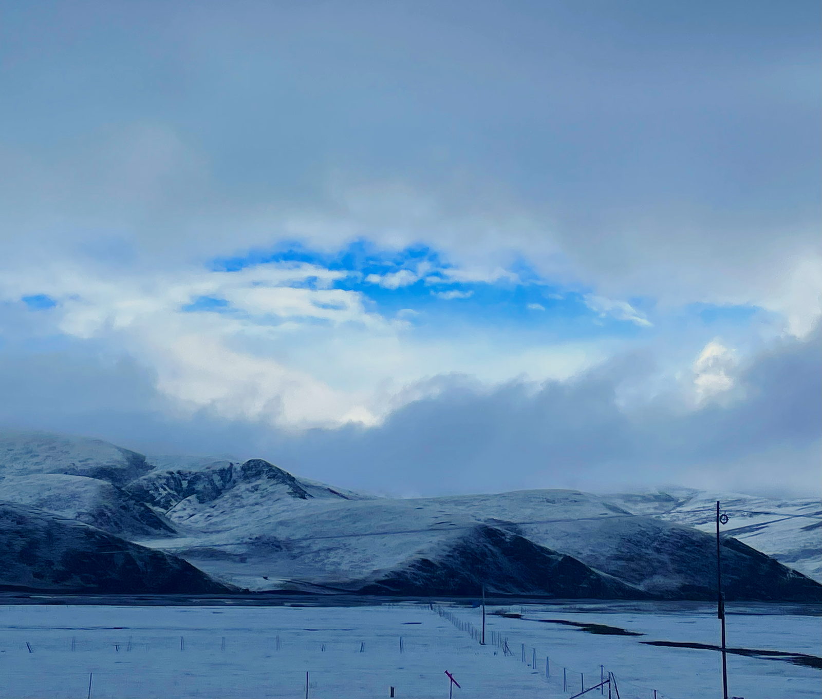
Anemaqen is one of the four sacred mountains of the Tibetan world — named alongside Kailash in Ngari, Kawagebo of the Meili range, and Gado Juewo in Yushu. The main summit, Maqen Gangri, is 6,282 m and the highest peak of the eastern Kunlun; "Ani" means ancestor and "Maqen" the great mountain at the source of the Yellow River, and the Yellow River bends around the massif on its way east. There are more than forty glaciers on it, around 150 square kilometres of ice, including the largest glacier in the whole Yellow River basin. It has been a national geopark since 2012, and it sits about 80 km from Maqin's county town.
I hadn't come for the mountain alone: a few friends of mine were running a trail race on it that weekend. I didn't find them at the race — those courses are long — but we met up in Maqin county town afterwards and ate together at Golog Suotang yak-beef noodles . Open 24 hours, cheap, good, and the portions are enormous: one bowl between two people is genuinely enough. Write that down if you ever pass through Maqin hungry.
Then the drive that is the real reason to do this route: south through Jigzhi , across the provincial border at Aba , and on to Barkam , the capital of Aba prefecture.
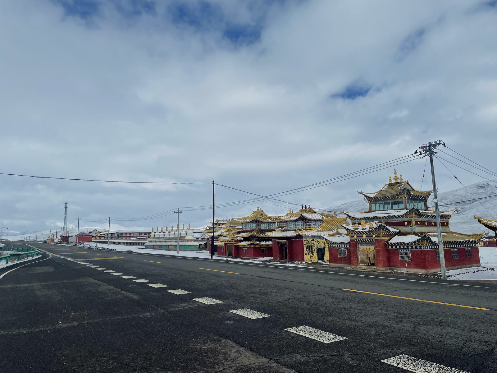
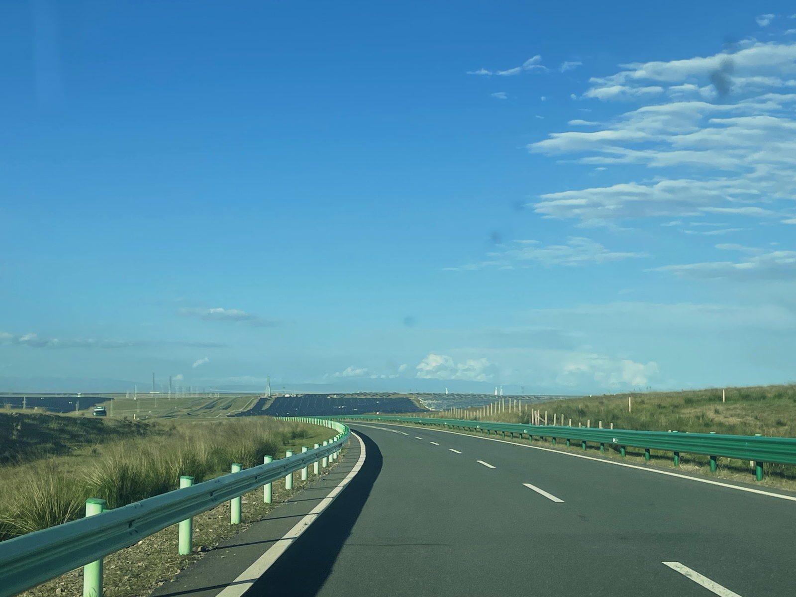
The Jigzhi–Aba stretch is, as far as I'm concerned, the best thing on my YouTube channel, and I'll tell you why it looked that good. The expressway between Jigzhi and Barkam — the Jiuma expressway, the first road of its kind to link Sichuan and Qinghai — only opened to trial traffic at the end of 2022 and is still being finished in sections. When I drove it, it was in trial operation and there was almost nobody on it. Empty four lanes across 3,000-metre grassland, and no traffic at all. That combination will not last; the road will fill up the way every good road in China eventually does.
One honest note on that stretch: Jigzhi is also the county of Nianbaoyuze , the peak-and-lake area once known as the gods' back garden. It has been closed since April 2018 to let the grassland recover, and it has not reopened. Don't build a plan around it.
Where you sleep: the Dust Settled Hotel in Barkam — a Howard Johnson property on the river front, and a genuinely good one: comfortable, well run, and the best night's sleep of the three days. The name is a nod to A Lai's novel The Dust Settles, which is set in the chieftain's country this valley belongs to. But the thing I'd actually send you there for was the next morning, and it wasn't the hotel at all.
Day 3 — Mushrooms, then down the valley home
The market under the hotel is the reason to be in Barkam in August. It was the tail of wild mushroom season in the western Sichuan mountains, and the stalls were full of it. I bought a serious bag of fresh mushrooms and drove home with them, and that night they went into a pot with local yak beef and some dried mushrooms, and the soup that came out of it is the best thing I cooked all month.
Then the drive down. The valley road out of Barkam runs past Zhegu Mountain , the ski area on the G317 between Barkam and Miyaluo — 3,000 to 3,700 m, the highest natural ski field near Chengdu, and the one we use in winter. It isn't the closest ski area to the city, which is exactly why we go: it's the one that takes dogs. The Tibetan-style cabins up there are pet-friendly, and the snow season runs from late November to the end of March.
Below it is Miyaluo , the largest red-leaf area in China — nearly 3,700 square kilometres of it, strung along the G317, with no gate and no ticket: the leaves are simply on both sides of the road, best from mid-October to early November. Somewhere in that valley there is also a genuinely luxurious hot-spring hotel where you sit in hot water and look at snow mountains; it runs about ¥1,200 a night, which is why I drove past it.
Then Bipenggou — the valley everyone photographs in October, when the whole gorge turns. I was in a hurry to get home, so I didn't stop, and that's the honest trade of this day: the road gives you three famous valleys in an afternoon and you have to choose between seeing them properly and sleeping in your own bed.
The last stretch is Wenchuan , and I don't want to drive through it without saying why the name lands differently for Chinese people than it does on a map.
On 12 May 2008 at 14:28, an earthquake of magnitude 8.0 struck with its epicentre at Yingxiu, in Wenchuan county. Nearly seventy thousand people died, and around eighteen thousand were never found. I was in fourth grade, in a music class on the fourth floor of a school in Chengdu, and I felt it — everybody my age in Sichuan felt it, and almost everyone in the country knows exactly where they were. It is the reason the buildings along this valley look the way they do now, and the reason the mountainsides are stitched with netting.
If you have the time, the two places worth going out of your way for are the ruins of Xuankou Middle School in Yingxiu — kept as it fell, with a stone clock in front of it stopped at 14:28 — and the old county town of Beichuan , preserved whole. Both are memorials before they are sights. Go quietly.
From Wenchuan it's an hour and a half of expressway into Chengdu, and the trip ends where it started: a car full of mushrooms and three days of empty road behind me.
Things people get wrong here
Six that catch people out
"Hainan" here is not the island. Hainan Tibetan Autonomous Prefecture is in the middle of Qinghai, and Gonghe is its seat. Every year somebody books a flight to Sanya by mistake.
Bird Island and Sand Island are closed. They have been shut to visitors since August 2017 to protect the wetland, and the closure has not been lifted. You see the birds from the shore roads, and you do not get closer.
The mirror at Chaka needs weather to cooperate. Wind or cloud and you get a white lake instead of a mirror. There are also two separate scenic areas at Chaka now, on different sides of the town — check which one you are buying into before you drive in.
Nianbaoyuze, in Jigzhi, is closed. It has been shut since April 2018 and has not reopened. The road past it is beautiful anyway; the gate is not open.
This route starts high and stays high. Xining is 2,261 m, the lake is 3,196 m, Chaka is 3,059 m, the hot spring is near 3,900 m, and Anemaqen's summit is 6,282 m. Going home does not mean going downhill — most people feel the altitude on this direction more than they expect, so keep the water up and don't stack a hard hike onto the hot-spring night.
The new expressway is new. The Jigzhi–Barkam expressway opened in stages from the end of 2022 and is still being finished; parts of it run in trial operation, and service areas are thin. Check the current status before you plan a day around it, and don't count on fuel or food along it.
How to give the day to the right light
On a driving route the temptation is to arrive, photograph, leave. The version that works better here is to pick the two hours that matter and build the driving around them.
- First light — the camp at the hot spring, steam in cold air; and the shore of Qinghai Lake if you sleep near it instead.
- Mid-morning to mid-afternoon — the long drives. On this route that is most of every day, and on the new expressway there is nothing to stop for anyway.
- Late afternoon — Chaka in good weather, and the Barkam river front, which is at its best when the sun gets low over the water.
- Last hour — the Golog grassland south of Maqin, and any of the passes. This is the hour the whole route is built around.
- After dark — the sky at the hot spring. At 3,900 m with no town nearby, step outside before you sleep.
If you're coming to shoot
This is a driving route, so the camera question is really a car question: everything you carry, you carry for three days, and two of those days have no resupply worth the name. Pack for that, not for the pictures.
- A long lens earns its place on the Anemaqen morning — the mountain stays far away until the last approach, and the compressed version is the one that reads.
- A polariser, not a filter stack. At 3,000–3,900 m the sky is already doing half the work; what you need is control of the glare off water and salt.
- Batteries live in an inside pocket. The hot-spring night is close to freezing in any month; cold batteries die at the worst moment.
- The empty road is the shot. On the Jigzhi–Aba expressway the picture is the absence of traffic — shoot it from the passenger side while it lasts.
- At the Wenchuan sites, the camera comes down. These are memorials. Photograph the place, not the people grieving in it.
If you only have two days
Skip the lake loop. Leave Xining south on the G214, take the hot spring as your first night, and do Anemaqen, Maqin and the expressway over into Sichuan on day two, overnighting in Barkam. That is the spine of this route with the detour removed — and it is the version I would give anyone who asked for the drive and not the sightseeing.
Questions I get asked before this trip
How many days does it take?
Three driving days and two nights, the way I did it. Two days is possible if you skip Qinghai Lake and Chaka; one is possible and I don't recommend it — that is the "get home" version, which is what this route exists to avoid.
What's the best time of year?
I drove it in August and I'd drive it again then: the grassland is green, the mushrooms are in in Barkam, and the passes are clear. Late June to early October is the honest window. October adds the red leaves in the Miyaluo valley and takes away the mushrooms; from December to March, Zhegu Mountain is a ski trip and the Qinghai legs are a cold-weather trip.
Can foreigners do this route?
Yes. Nothing on it needs a permit, and there are no closed areas on the driving line itself — the closed places near it, Bird Island and Nianbaoyuze, are closed to everyone. Barkam, Aba and the whole valley road are ordinary Sichuan prefecture towns with ordinary hotels.
Do I need to book anything in advance?
Only Barkam, and only in the mushroom season or the red-leaf season, when the good hotels fill up. The hot-spring night is a camp; the rest of the route is county towns where turning up is normal.
What about fuel and charging?
Plan it rather than assume it. I charged at the Gonghe service area and again in Heka town and that worked, but the gaps south of there are real — on the new expressway the services are still being built out. If you drive a combustion car, fill up at every county town and you'll be fine; the distances between towns are the thing to respect, not the roads.
Is the camping at the hot spring safe and legal?
I camped where I parked and had no trouble, but I'm a local driver in my own country and I'd rather not generalise my night into a rule. Ask at the hot-spring area when you arrive — the people who run the pools will tell you in two minutes whether they want you staying the night, and that answer is the one that counts.
Which direction should I drive it?
The way I did it — Xining to Chengdu — puts the two big sights at the front and finishes on an easy expressway home. Reversed, you get the climb out of Chengdu done on day one and the lake at the end, which is a fine ending but a harder first day. If you're coming off a long trip and tired, do it my way.
Honest notes
Everything in this guide comes from roads I drive myself. Conditions change: an expressway section opens or closes, a scenic area shuts, a price moves. If you get there and something is different, tell me and I'll correct this page.
The distances and driving times in the route map are approximate road values from public mapping, not a stopwatch record of my own driving — and the leg from the hot spring to Anemaqen is the one I'd treat as the roughest. Where I've named a hotel or a restaurant, it's somewhere I stayed or ate, not a paid listing. The one thing I haven't done on this page is invent detail about the hot springs' history or the mountain's rituals: the figures I give about Anemaqen and Qinghai Lake are the published ones, and the rest is what I saw.
Most of the photographs on this page come from the corridor this route drives — Qinghai Hainan and Golog — though not all of them were taken on the August run; the rest are from other legs of the plateau, and I'll swap the last ones in when this drive's footage is graded. The words are about the roads I actually drove, and I'd rather tell you which is which than mislabel a picture.
If you want to know what the light is doing in the month you're thinking about, or how this route would fit the dates you have, that's a question worth asking before you commit — write to me.